
This article is part of the series Recalculating, a 28-day motorcycle journey along the Pacific Northwest coast and through its volcanic landscapes.
Somehow the month of May changed me. I found myself carrying more caution, anxiety, and worry into this trip than I had on any previous adventure. The flat in the Sacramento River Delta, the complete failure of AAA, and the myriad of bike problems across the Southeast made me view this trip differently.
It wasn’t necessarily the ride from the Bay Area up to Vancouver — it was the adventure east to Glacier, Yellowstone, and Grand Teton National Park, and the long distances between them with unpredictable weather and all the unknowns surrounding it. That anxiety needed somewhere to go. Today it landed on my battery.

I mean, I think it’s fine. The battery is three years old, which means it’s getting near the point where I should think about changing it, but it’s not a lost cause. The little icon on the screen is still green. Sometimes it says 12.9V. Other times it shows 12.3V. I haven’t seen an 11, yet. It sounds a little slower than normal, but maybe I’m just reading into things that aren’t there. Since it always takes me longer than I think to get on the road, I decided to swing into So So Cycles on the way out of town. If anyone would know, it’d be them — they see this kind of bike all day long and flagged the slow starting three years ago. After talking with a few folks at the dealer, they thought I’d be fine.
Northbound I go.
I hit the road in earnest around 10:30. It was a lot later than I wanted to get started, but the confidence that my battery would be fine was worth the additional penance and payback waiting at the north end of the valley in the form of triple-digit heat. Interstate 680 became Interstate 80, which then folded into Interstate 505, a small commuter highway to points beyond. The Bay Area was now behind me.
Wandering north on the 5, my mind drifted back to the decision to leave the camping gear at home. I don’t mind motorcycle camping in small doses. Both BMW clubs I’m part of have motorcycle camping as part of their annual tradition — I was trying to trade off the flexibility of having camping gear against the logistics of hauling it as a passenger on the backseat. It’s never really secure when I’m off the bike. It makes it harder to get on and off, and if I’m honest with myself, at the end of a long day I like a hot shower and a comfortable bed. After discussing it with R, the camping gear stayed in the garage. But what if I couldn’t find a hotel room on the backside of Glacier in the pouring rain…


I had a 1:30 appointment with my endocrinologist for a standard check-in. One of the benefits of the pandemic is that medicine is far more accessible than ever thanks to video visits. In some ways it felt like an eighth-grade algebra problem: A motorcycle is traveling north on a motorcycle at 70 miles an hour, which city can I arrive in that has good cell service, good food, and is still within the state of California, with an arrival time no later than 1:25? As luck would have it — Red Bluff.
I’ve often dismissed this town as uninteresting and uninhabitable on a motorcycle during the summer. At some level, it’s true — flat valley topography extends in every direction, and during the summer it’s often on either side of 100 degrees. However, it becomes a great launch point for almost everything worth riding in far Northern California. After my Shasta Cascade run, it became clear that Red Bluff is an excellent Friday night destination — traveling north on the freeway in the relative cool of evening puts you three hours closer to a fun Saturday morning.

The endocrinologist was mostly happy with my performance over the past few months. In 26 years of diabetes, I’ve never once gotten a “you’re doing great, I have nothing for you.” Even with a sub-seven A1c, my endocrinologist still had feedback. She laughed at my algebra problem and noted I’m not the normal patient she sees throughout the week. But I’ll take her good review over a burrito bowl any day, with plenty of adventure still ahead.
While the stretch of valley between Vacaville and Red Bluff was mostly cool (for the Central Valley in summer), the section between Red Bluff and Mount Shasta couldn’t have been more brutal. The thermometer was pegged at 100 and didn’t relent, even climbing through the mountains toward the massive volcano.
I took a short diversion over to Castle Crags State Park. I’ve driven by it a number of times and only stopped once, to be accosted by bees. However, the crags themselves are so beautiful from the freeway that it was worth one more stop to see if I could find a place to photograph them. I stopped at the ranger station and mentioned I didn’t have my Poppy Pass but wondered if there was a place to photograph the crags from a distance. She instantly lit up. “Yes — take the road you came in on another four miles, and you’ll see a beautiful view from the west.”

As soon as I started down that road, I saw a sign noting the pavement would end two miles before the viewpoint she’d promised. My heart sank, and I started wondering: should I take the unpaved route, traveling alone? I’d probably be fine. But what if I’m not? If anything, I figured I’d keep riding while it was paved and make the call when the pavement stopped. Maybe it was hard-packed dirt, almost as good as pavement. Just because it’s not paved doesn’t mean it’s 24 inches of deep sand, right?


As I rode along, the pavement never stopped. The road rose into the mountains and opened up a striking view of the crags from the back side. Wow. I love the (H) hold feature on my bike. I can keep the bike in neutral and the brakes will hold it in place while I take a pic of the bumpy, paved road and the crags ahead of me.
Recently I’ve been thinking about being more explicit in saying thank you for things a little off the path of normal pleasantries. I circled back to the guard gate and said, “I know you give out all kinds of information all day long, and it can be a bit of a thankless job. But I wanted to say thank you for that recommendation — the view is truly excellent, and I wouldn’t have found it without your guidance.” She instantly lit up, smiled, and said thank you. With that, I continued north.

Just past the sign for the Mt. Shasta Wilderness trailheads, another one catches my eye every time I ride this stretch: Military Pass Road. I’ve read up on it more than I’d like to admit — old lava fields, backcountry views of Shasta you don’t get from the highway, exactly the kind of road this trip should have room for. Every time, it’s the same math I did outside Castle Crags: it’s dirt, I’m alone, and today isn’t the day. Maybe next time, with someone riding behind me, I’ll follow the arrow to the east instead of the highway to the north.

Everitt Memorial Highway climbs the southern flank of Shasta from town all the way to the Old Ski Bowl — about 14 miles and 5,000 vertical feet of glorious pavement, topping out just over 7,800 feet. It’s named for John Everitt, a Forest Service supervisor who died fighting a fire on the mountain back in the 1920s, the first forest supervisor killed doing the job. The road was originally built for a ski park that opened in the ’50s and got wiped out by an avalanche in 1978.

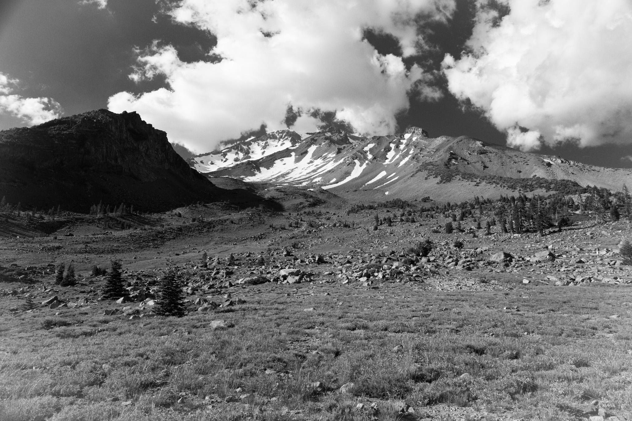
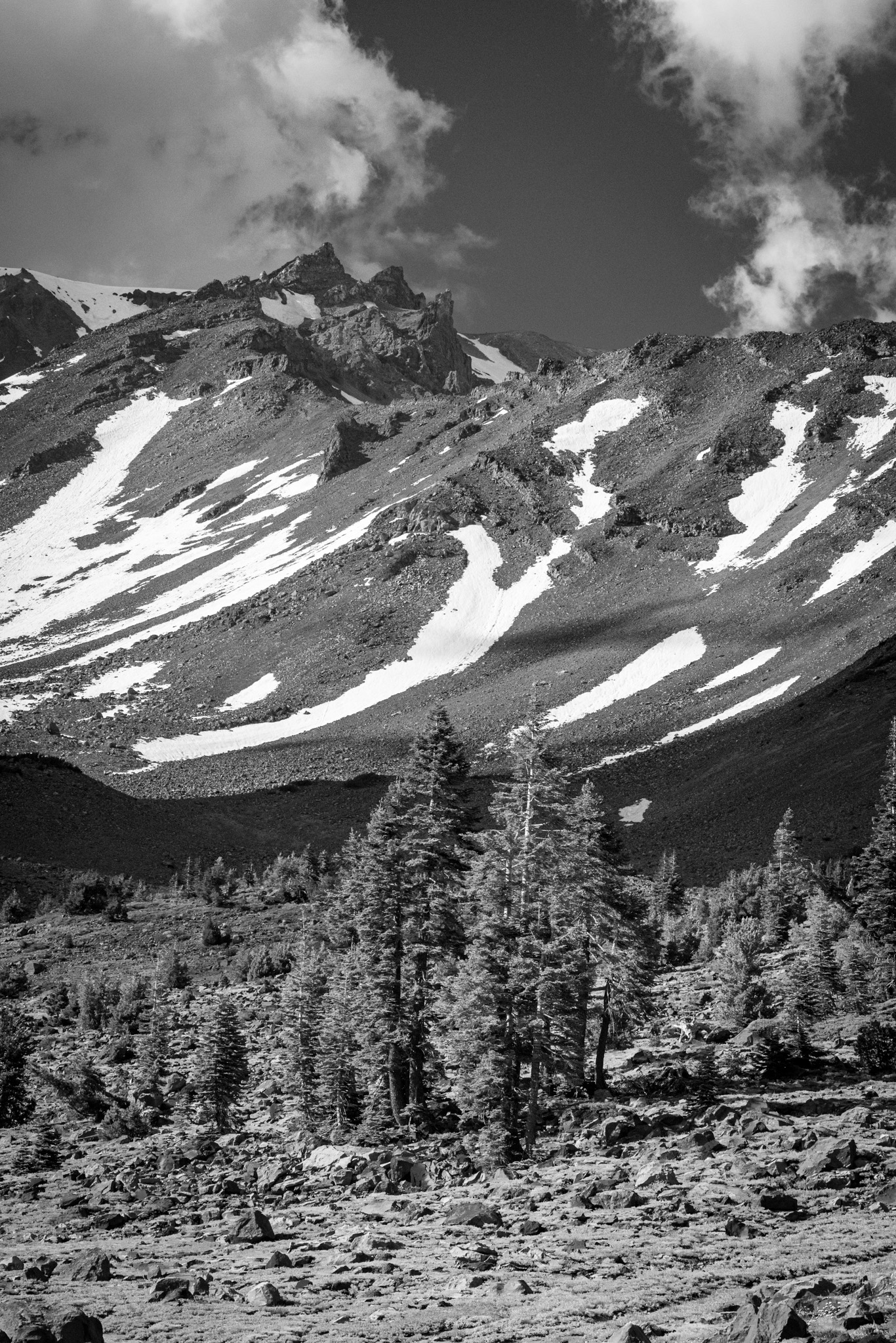


By the time I got to Mount Shasta, I had downed two quarts of Gatorade Zero with almost nothing coming out. I needed to get out of the heat. I called on an old friend — the Everitt Memorial HighwayParkway up to the Mount Shasta ski bowl. This is an out-and-back of glorious pavement that climbs about 5,000 feet to the base of the volcano. Soon after I parked, this giant diesel truck pulled up next to me, and out stepped John, from AgCon Construction. He was building some kind of conservation easement in Gazelle, just east of the volcano, and was also looking for some time in cooler temperatures. We laughed — turned out he used to live near me and then got out of town for more sparsely populated pastures outside of Sacramento.


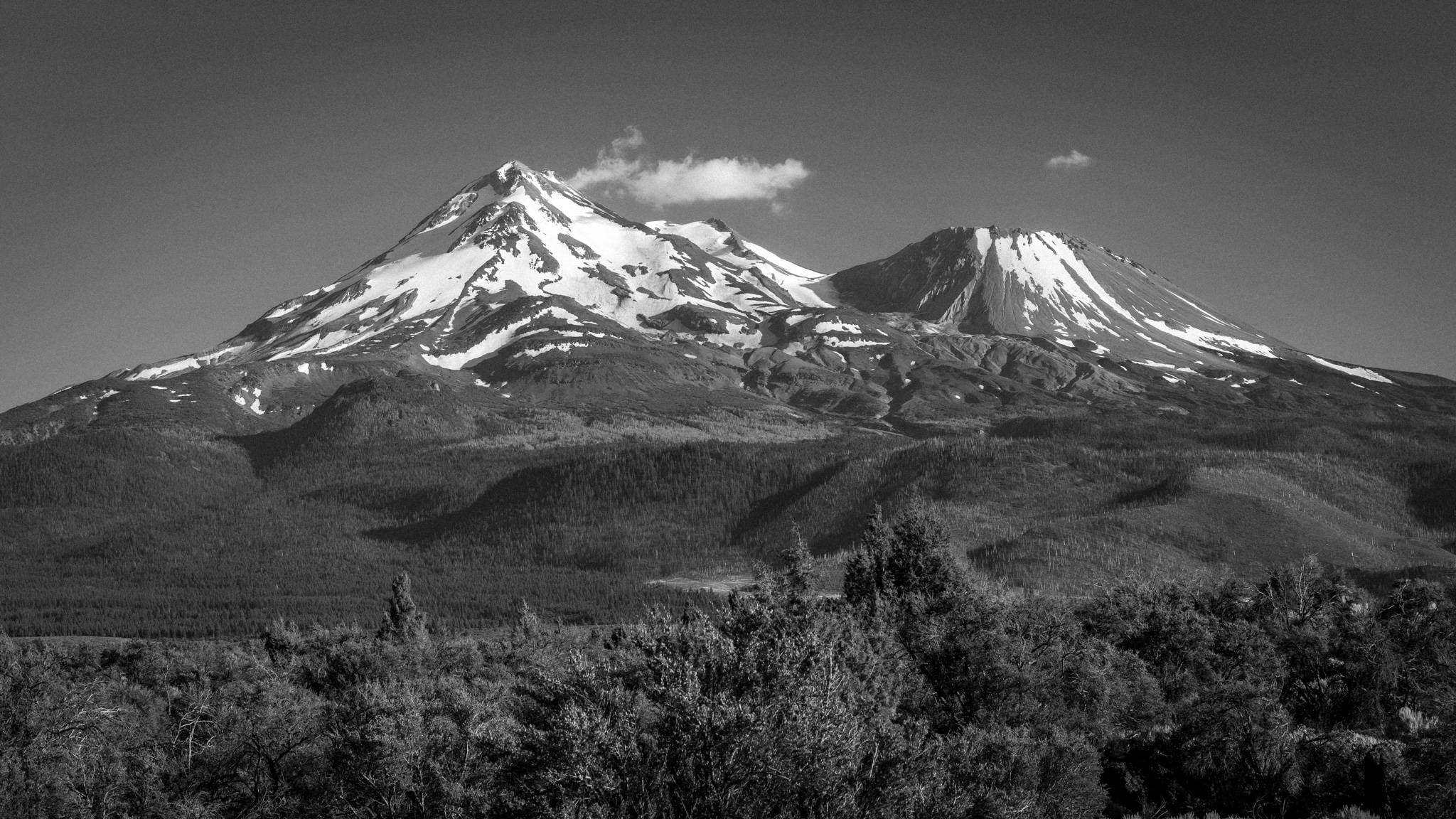
At 6:30, time was starting to get away from me, and I still had about two hours to go before Klamath Falls, Oregon. I’d made the decision to get out of California on day one, for more flexibility — shorter days from here, or more twisties on the road north. Soon the volcano’s twisty highway became Interstate 5 for a brief moment before I pulled off onto US Highway 97, around the back side of Shasta. I was about an hour early for golden hour, but the light was beginning to soften and the color of the mountain was beginning to come out. I could feel the effects of being farther north — the sunset was later than I expected, even compared to chasing the sunset on Mount Diablo the night before. The 350 miles north pushed the sunset demonstrably later.

I pulled into Klamath Falls just before 9 p.m., tired but full from a day of riding. California was behind me now, battery and all. Tomorrow it would be Oregon, and whatever came next.

Ride Details
Route Map
Start
Bay Area, California
Destination
Klamath Falls, OR
Distance
375 miles
The Ride at a Glance
Scenery
★★☆☆☆
Curves
★★☆☆☆
Road Surface
★★★★★
Traffic
★☆☆☆☆
Difficulty
★☆☆☆☆




Leave a Reply