
Welcome to Oregon!
One of the big things I’m excited about learning on this trip is how to drive my EV. Effective drivers know how to maximize the battery’s usage, consumption, and range. I don’t want to continually start to charge, but I don’t want to get stranded, either. Because I don’t know the roads or the charging networks ahead of me, I must learn how to use the tools in the truck and on my phone to successfully navigate how to get from here to there.
The most common question I get with the Rivian is, “How far will the truck go on a charge?”. As with many things, “it depends.” Generally, electric vehicles like to sit between 30 and 70% to maximize battery longevity. Longer road trips will stray out of those ranges, of course. I try to make it a practice to use energy above 70% quickly and charge when the truck drops below 30% at my destination, so I am minimizing the time my battery sits in the outer edges.
The second most common question is, “How fast will it charge?” Again, it depends. If I use a level II charger (think 220 V dryer in your garage), I get 22 mph which means overnight charging. “Fast” Level 3 chargers span the gamut of speeds – topping out at about 550 mph, provided I’m in that 30-70% range. Charging outside of that range slows the rate of charge.


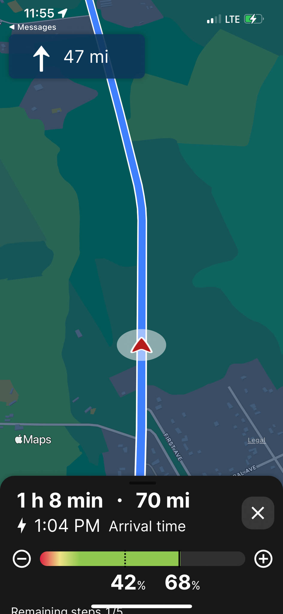
Google Maps has been my go-to for almost 20 years. Google Maps is woefully inadequate to support long-distance EV travel when driving in EV. Google Maps doesn’t support routing through EV chargers, battery burndown, and vehicle/climate information to dictate charging frequency.
A new player called A Better Route Planner (ABRP) meets most of these challenges. In a surprise move, Rivian acquired ABRP to improve its routing inside of the truck (you can see me in the video!). A fire broke out near Oak Ridge, Oregon causing a massive diversion in my route. Rather than charging in Bend and crossing 58, I’d have to go through Crater Lake National Park and incur a 5000-foot climb navigating through the park.
EV Insight: Electric vehicles hate climbing hills and love going down hills.

I didn’t have good insight into how the truck’s range would perform in an unknown climb, so this was my first opportunity to learn to trust the tools. I’ve divided my trip into three sections: the climb to the Rim Lodge at Crater Lake National Park, the descent to Glide, Oregon, and the balance into Roseburg.
In the charts below, it’s easy to see elevation significantly impacts range. Speed does as well. However, I was driving faster down the hill and up the mountain and still got better coverage. As a reference point, my efficiency over 10,000 miles is about 2 miles per kWh. That’s why I was so concerned about a long descent the day before without charging in the Valley. I didn’t understand the impact of the climb back up to the charger. The worst range in the truck was about 0.7 miles per kWh, climbing the Sierra Nevada at speed in the winter. That same drive in the summer was about 1.1 miles per kWh.
In contrast, going down the hill charges the battery. The truck doesn’t need to expend nearly the energy and reclaims some energy lost climbing the mountain. At one point, I was getting over 4.0 miles per kWh – almost twice the average.
ABRP’s iPhone app features a way to track battery usage as you’re driving. I was easily able to compare my current range with where the app thought I should be. If I started deviating (which never happened) I knew trouble was brewing. At that point, I’d have to go find additional charge.


- Elevation Change: +3006
- Battery Loss: 29%
- Mileage: 59
- Miles / kWh: 1.50

- Elevation Change: -6412
- Battery Loss: 25%
- Mileage: 85
- Miles / kWh: 2.51

- Elevation Change: -538
- Battery Loss: 7%
- Mileage: 16.7
- Miles / kWh: 1.90
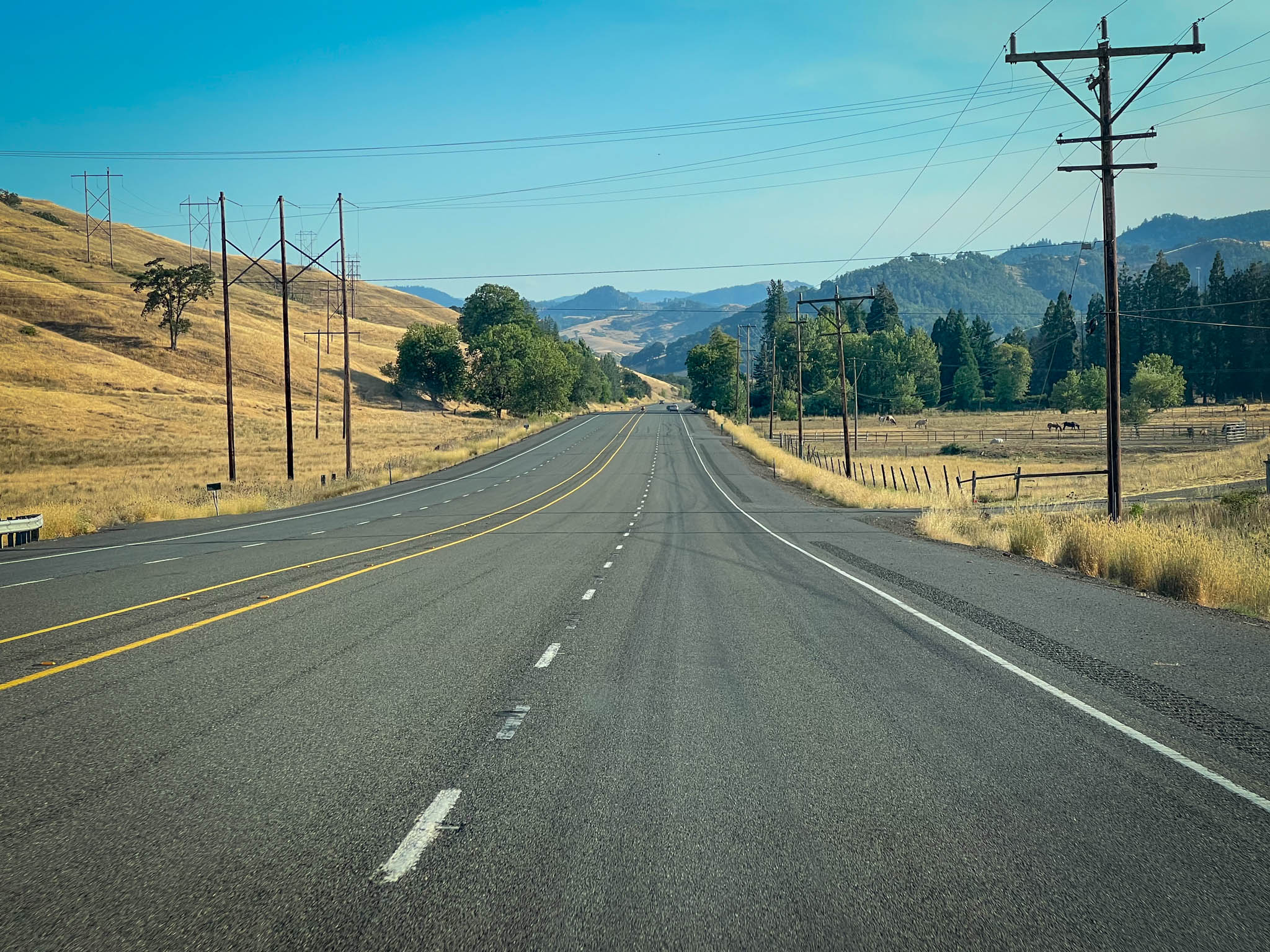
As soon as I started climbing into the mountains, I was glad for the diversion. The air was fresh and I’d forgotten how beautiful Crater Lake National Park really was. Whether in Oregon or Northern California, the mountains are beautiful. That same 2005 trip (The Long Leg) brought me through here, just going the other direction on a yellow motorcycle rather than a yellow truck! The team at Rivian really did build a polished truck. I’m surprised at all the small details that I find driving this truck. The yellow brake calipers with the factory logo are a nice touch!


As soon as I saw the lake from the top of Rim Road, an unexpected “Holy F… That’s beautiful came out of my mouth.” I knew it was blue, but I didn’t think it was that blue. The color in Greater Lake blows Lake Tahoe entirely out of the water!
Somehow I also disconnected how high Crater Lake and the Rim Road are. This trip would bring me just over 8000 feet before the descent to Roseburg. I’d always pictured the Cascades as shorter, steeper mountains rather than the gentle Western slope of the Sierras. I won’t deny that the yellow indeed looks outstanding against the blue. It’s a little bit of proud owner syndrome settling in 🙂
I did park next to the white Tacoma for the new truck/old truck photograph. I loved my Volt for what it was, but there were just certain things the Volt would never be able to do – like off the beaten path adventuring. As I make my way into eastern British Columbia, Idaho, Montana, and Nevada, I think the Rivian’s weaknesses will start showing up, as charging is not nearly as ubiquitous in those states as they are along the western seaboard. For now, adventuring is excellent 🙂


The drive from Crater Lake to Roseburg was the first long downslope of the trip. I’m always delighted to see the truck’s regeneration max out at 4 miles / kWh. All the anxiety around climbing mountains melts away with copious amounts of energy flowing into the truck!

After years of driving a gasoline (or ICE, internal combustion engine as EV drivers call it) car for years, I fluently speak gasoline, miles per gallon, etc. One of the significant steps in driving an EV is to build the same knowledge around electrical energy in kWh.
The drive from Klamath Falls to Roseburg was a net loss of about 4000 feet which helps the Rivian get more range. The Rivian got about 2.4 miles per kilowatt hour between Klamath Falls and Roseburg. The math doesn’t quite add up between the charts above and the total here, as I wasn’t tracking that tightly. Still, more illustrating the point that elevation does have a demonstrable influence on the range of an EV.
EV Warning: don’t go down a long hill without being sure you can get back up, lol. Just because you can go A to B doesn’t mean you can go from B to A.


What else can 68 kWh do?
To help get a better sense for the amount of energy behind 68 kWh, here’s a comparison:

3 days of AC on hot days

22 loads of laundry

34 years of daily charging a phone

1 week of hot water using an electric heater
I arrived in Albany, Oregon, right about sunset. Here, the adventure creature comforts in the truck began to show. The door has a flashlight which made navigating the campsite easier. The household outlets inside of the bed made inflating the air mattress a breeze. While I didn’t use it, the speaker underneath the center console will be a nice addition in more remote campsites.
All in all: a great day!
Leave a Reply