Day 1: 191 miles
I got an invite to go on a ride with some of my co workers. It turns out that this ride has been going on for about the last 20 years as the Memorial Day lap around northern California. This year they decided to move it out a week. I am always looking to meet new folks and ride some new roads so figured why not go. All of the NorCal crew met in San Jose. The final destination was Mariposa where we’d meet the SoCal crew. It was not a long ride. We’d ride about 200 miles, but it was to be a technical 200 miles.. The plan was to go over Mount Hamilton, cross the valley, and bump up into the foothills. The ride up Mount Hamilton is always a challenge for me. The road is very tight and technical with a lot of blind corners that have crud in them. This time was no exception. Once getting to the top of the mountain, the view was pretty cool!
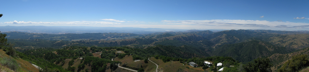
We had a great view of San Jose:
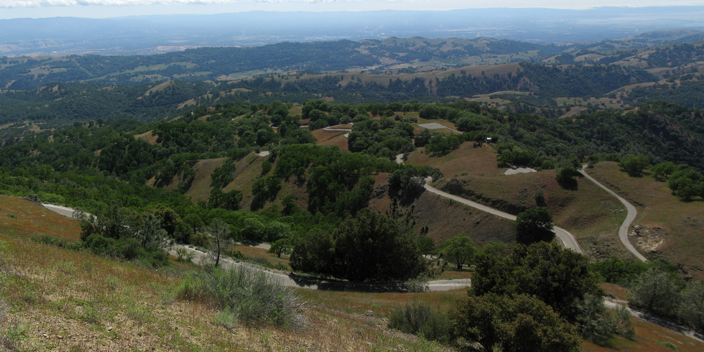
But it is one technical ride up:

Riding down the mountain was much easier for me. Usually downhill riding gives people more issues as gravity does not help you control your speed. For some reason I felt better heading down. Once in the valley we all jetted across as no one really likes to ride in straight lines when it’s hot. I picked up two new cities I’ve not been to before: Turlock and Merced. Not exactly megalopolises, but new none the less. We started up White Rock Road (why not just take 140 that goes right to Mariposa I dunno). The pavement went from bad to worse and crossing into Mariposa County it became downright crappy. Just about all of our dental work was knocked loose on this one. We went another few miles after the county line and the road became dirt. We had a choice to make: push forward on 8 miles of dirt or endure another 10 miles of crappy pavement. We chose the dirt. The pavement was that bad and we had a number of sport bikes.
This was my first real time being in the dirt on the DL. I’d done little bits here and there, but this time I actually had to get somewhere. I have to admit, it was more fun than I had expected and easier to ride. Granted I barely got into 2nd gear, but hey, it was still fun. We arrived in Mariposa shortly after 8pm or so and had a nice dinner at the local pizza place. I booked late at the Miner’s Inn as the Super 8 was full. Turned out for the better as the lodging was in much better shape. I had carpet while the others didn’t :)!
Day 2: 330 miles
Ain sort of peaked my interest in going over Tioga. He had to get a tire as his was wearing too fast. The rest of the group was heading over Ebbets, but I wanted to go over Tioga as it was opening day. Opening day usually has some of the best sights as the snow is still around and the rivers are running in full force. ZZ decided he’d rather ride over Tioga as well so the two of us set out due east. We got in free to the park as it was a go see your parks on the federal government day!
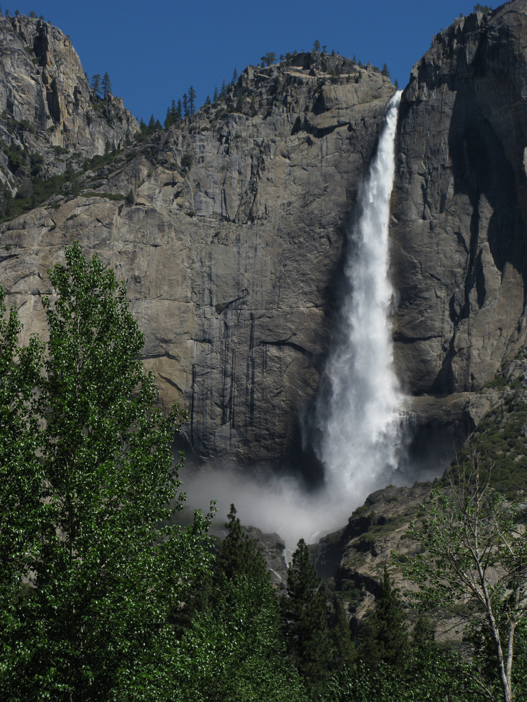
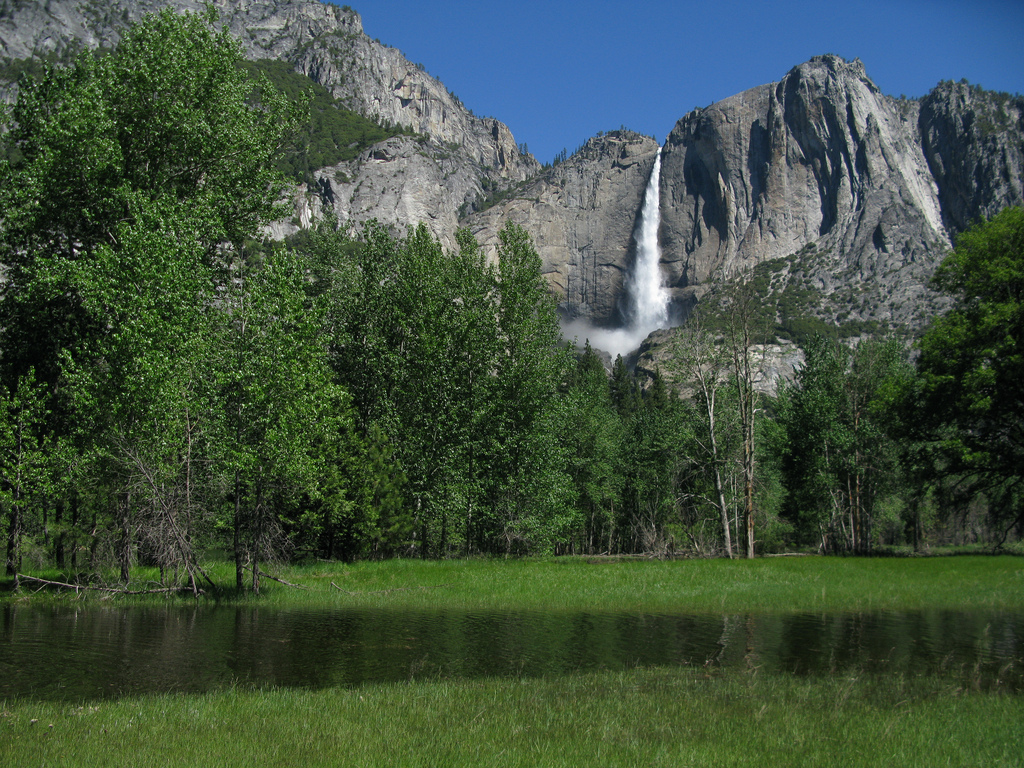
ZZ had never really been to the park much so we started off in the valley. The line into Bridalveil Falls was astronomical, so we kept on driving. The rest of the valley was pretty chill though. Not much traffic at all. Yosemite falls was in full force today:
With all the snow melt, the valley had it’s share of large puddles.

The ride up Tioga pass was really cool. The snow pack was very much around, yet we couldn’t find that wall of snow where we could lean our bikes into. It was not that heavy around roads. Yet we did have a bunch of water and in some cases deep streams on the roads:

Which became 6 or so inches deep on the road:

We took a few stops along the way to walk around and take pictures. The bikes are enjoying the rest:
Once past Olmstead Point, we got to see a number of lakes in the park. Most of them had a good amount of ice still on them from the winter. Tenaya is a favorite of mine to swim in, but Tioga looks best in the winter.
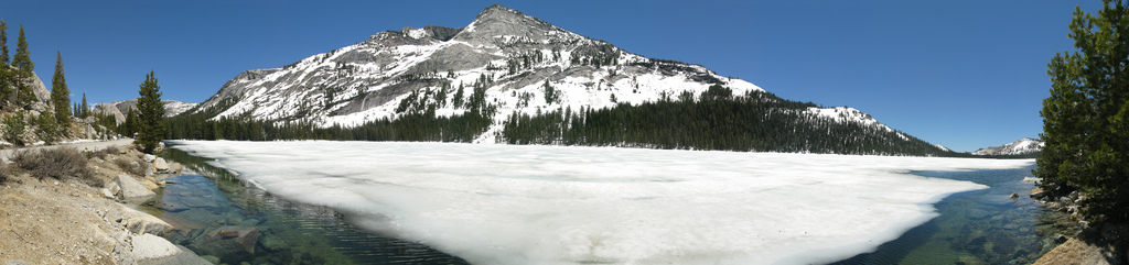
Tenaya Lake:
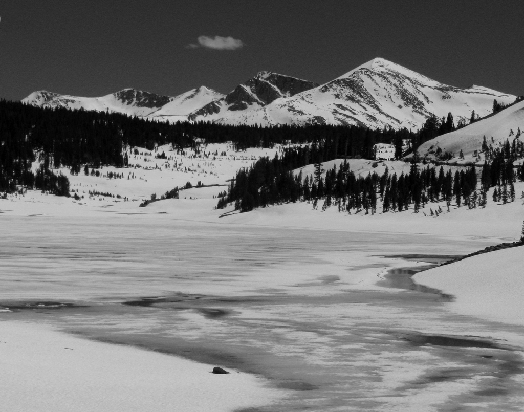
Tioga Lake:
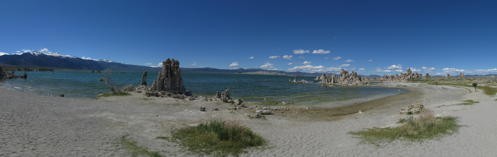
Once through the park we figured we’d explore Mono Lake. The dirt road to Mono Lake was a bit more challenging than the dirt from yesterday as the gravel is a bit deeper and there is less hard pack. The lake is a salt lake much like the Great Salt Lake. For some reason the flies were not around today:

The salt structures on the lake are known as tufa. How they formed, I’m not sure, but they are cool up close:

On the way to Mono Lake I realized we had to swing by June Lake so we took yet another detour:
It was now nearing 5pm and we had to get to Shingle Springs for dinner. Our timing was less than stellar. The good news is that the other group’s timing was about as good as ours. We had about 150 miles to ride (about 3 hours) to get to dinner. It was one of those ride, gas ride, repeat sections. Dinner was a nice BBQ outside of Sacramento. Many thanks Rick and Janice.
Day 3: 420 miles
Day 3 started with a great view of the snow capped mountains outside of Placerville. I was bummed I was too lazy to get a picture of them. :(. We had a fair amount of riding to do and we started late, but hey, we roll with the crew. Evan, one of the route guys had suggested we backtrack on 80 to 89. I had suggested we take 70. With a little bit of creative suggestion, the group went with 70. Evan sort of gave me a nod and said “you know how to ride California don’t you..” Yeah, I’ve been a few places. Actually I’ve been everywhere:
The ride up 70 was just awesome. The feather river canyon is one of my favorite rides in CA. We stopped for lunch along the Feather River and these two elderly ladies were having lunch in the same spot. Steve was having sort of a sweet tooth and figured the ladies might have some cookies. We all put him up to asking them for some. Turned out they did! We all got a big laugh out of that! We stopped at Lake Almanor and found that Lassen was still covered in snow:

The last 150 miles were to be the most technical.

Highway 36 is a legend in California motorcycling. It’s 140 miles of tight technical riding even for the most seasoned of riders. We got to the foot of the highway at about 6pm so it was cooling off in Red Bluff. Summers there can get over 100 easily. Very early on I knew this road was one that could not be trusted. There were a few blind rises where it appeared the road was to go left but it actually went right. That will wake you up quick! The top of the pass was quite cold and signaled more challenging weather ahead:
We had about 20 miles of deep fog where you could barely see the bike in front of you. The road switched to one lane and goaty in a few sections. It was late in the day, but the last section though the redwoods was pretty cool. The last bit of light in the day was fading through the tall trees.
Day 4: 360 miles
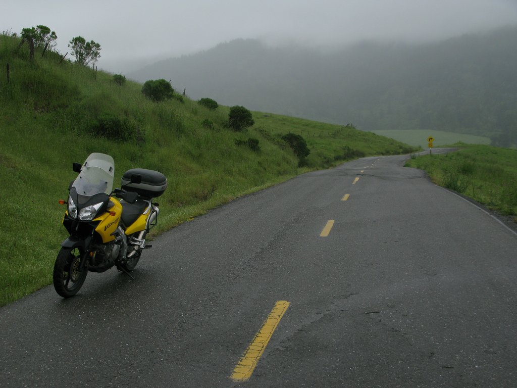
Day 4 was a run through the lost coast and down the regular coast back to San Jose. We started the day with some pretty foggy weather and some rain:
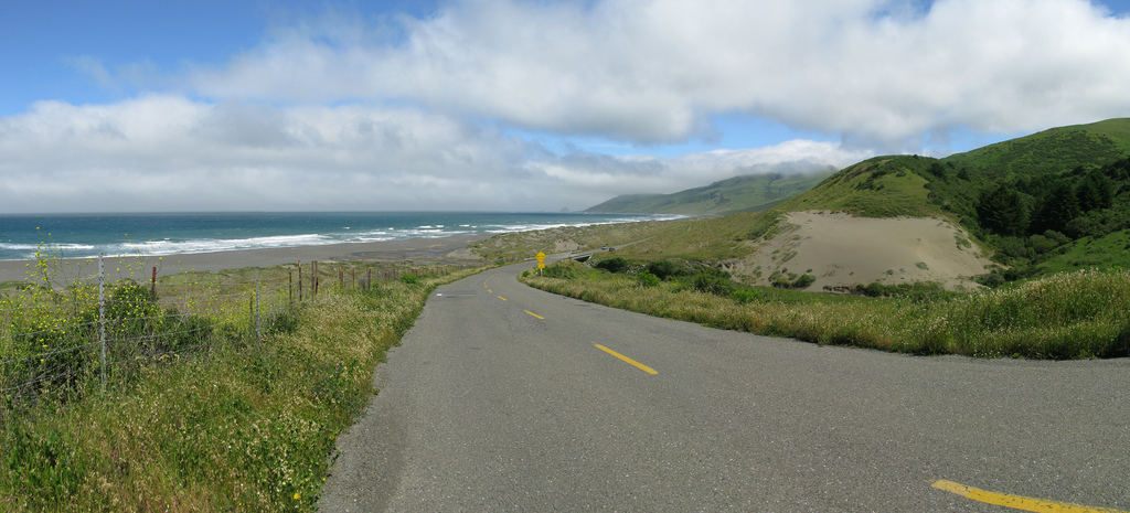
As usual things cleared up by the time we got to Mattole beach:

in Honeydew we got to hear all about Ferndale football and how the pot growers are destroying the region courtesy of Bob, the owner of the Honeydew store. Instead of taking Mattole through to US101 we decided to take Wildcat Ridge south to Redway. The pavement is much better (minus the mile of dirt) but I did miss the trees of Humboldt Redwoods State Park. We rode down the 1 to the first sign of coast:
Alas, all good trips have to come to an end. We rode down 1 to Bodega Bay and then hit the freeway to SF. We lost 1/2 of the So Cal group in San Francisco. I was supposed to lead them to their hotel in Burlingame but had no idea where the hotel was and had no GPS. With two strokes of luck the hotel was right off the exit and the others that got lost in SF met us 5 mins later. We had Matza Ball soup for dinner. It was actually really good! The So Cal group had a final day of riding back home and all reported it was a fun weekend!
Total: 1302 miles


Leave a Reply